Information
Distance: 22.1 miles;
Hills: a hill or two at the beginning (and end), long flat section along the River Pang
Traffic: *** generally quiet;
Surface Quality: ** generally good – some rough parts;
Date: 10/12/2011.
Route
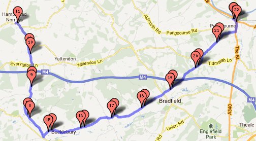
Going south from the station, we took the second through road on the right off the A340 – this is much quieter than the first road leading out to the west which goes through Upper Basildon. As soon as we had left the A road the road climbs steeply – also quite slippy with rotting leaves – so could be hard to get a good push. After this the road undulates until, having gone under the M4 motorway, is lovely and flat as it follows the river Pang. This was followed by some more undulation finishing at the pub in Hampstead Norreys (where we had been before). There is a great community atmosphere in this pub – the postman arrived to deliver some Christmas mail, and we kept coming across him on our skate back as he visited farms and villages Postman Pat style along the route.
Map
Pangbourne United Kingdom
